After three days of cycling on Via Claudia Augusta and a day of hiking in Imst, we hopped back onto our bikes to start our Innradweg journey. As mentioned in one of my previous posts, the Innradweg or Inn Cycle Path is a long-distance bicycle route along the river Inn and through the Alps. As with Via Claudia Augusta, we didn’t cycle the whole route (which would have been over 500 km long and started in Switzerland), but only a stretch of it starting in Imst. Our goal for the first day was to reach Innsbruck, the capital of Tyrol and the 5th largest city in Austria.
The downhill trek the day before gave our legs some muscle aches when we got up in the morning, but it was nothing that a breakfast with a view couldn’t alleviate. It also helped that we just had to sit on the saddle this time, and not walk the whole day.

We took our bicycles out of the hotel’s garage just before 10 am. It was hard to leave this gorgeous view behind.

At around 10 am, we caught the first sight of the river Inn in Arzl im Pitztal. A team of rafters practised on land as the turquoise water behind them glistened in the morning sun.


In Karrösten, we stopped by an educational board for Via Claudia Augusta. This is where our former bike route intersects with the Innradweg.

Onwards to Innsbruck!

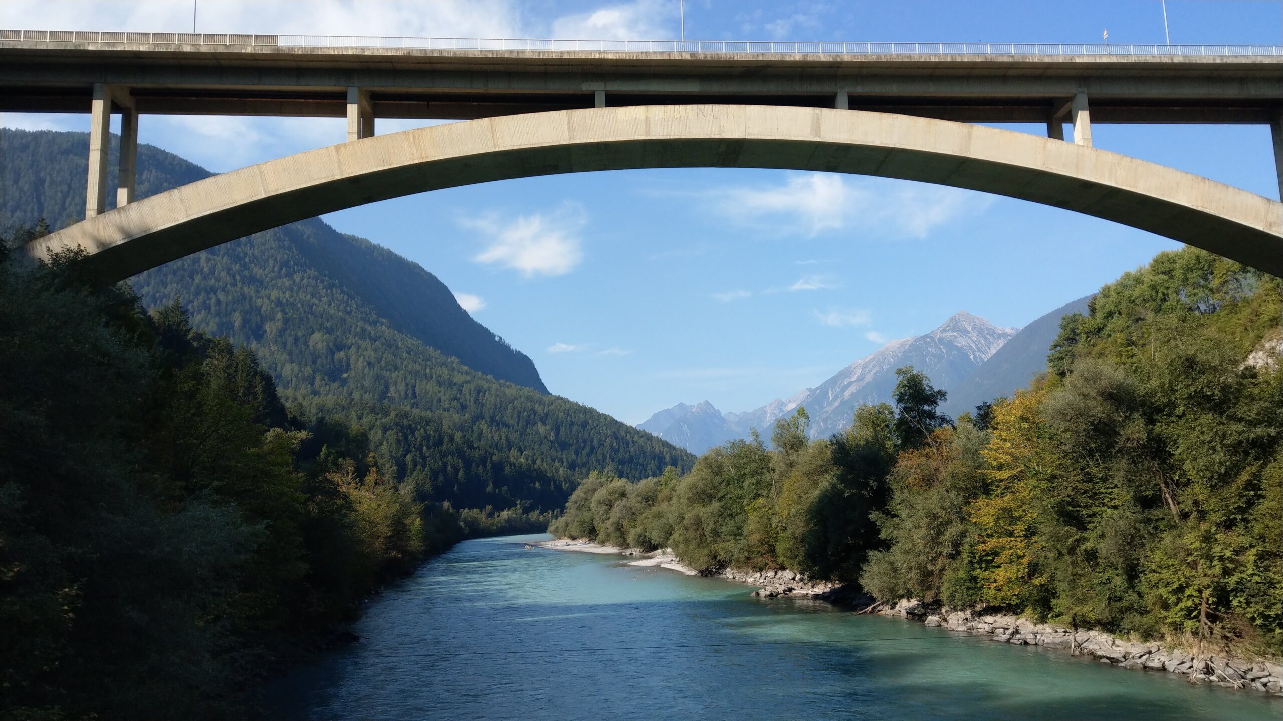
The first bridge we used to cross the Inn gave us the most stunning view of the river. The arch of the motorway above it frames the panorama perfectly.

Across the river, we cycled past the Imst-Pitztal train station and along the railway track on our right, while the river Inn flows on our left.
That day we met a few cyclists along the way and not just those on e-bikes, who made up the majority of cyclists on Via Claudia Augusta. I guess it wasn’t surprising considering the less challenging route of the Innradweg in terms of altitude change and type of surface. I would even go as far to say that the Innradweg is family-friendly.
Once the route stops following the railway, the Innradweg opens up to a beautiful view in Karres. You can’t see it in this picture but there’s a gorge on the left.

We crossed the turquoise-hued Inn once more.

Then the rafters we saw in Pitztal passed below the bridge we were on. They didn’t have to paddle, just let the gentle currents of the river take them downstream.
Shortly after crossing the bridge, we arrived in Roppen which welcomed us with a cafe right along the bicycle route, next to a sports ground. In our experience, this happens only rarely so we decided to stop there for a glass of Almdudler (me) and a cup of espresso (J), despite having finished our breakfast only a couple of hours before that. Look at this cute bar they provide for dogs!

A big group of cyclists came and invaded the cafe shortly after we finished our drink. Perfect timing to continue the journey!
We cycled on the main roads for a while and crossed the Inn a couple more times before reaching a forested area in Roppen. So green, quiet (you could just about hear the Inn flow on your right) and comfortable to ride. This portion of the route overlaps with the Jakobsweg a.k.a. Camino de Santiago a.k.a. the Way of St. James in Tyrol, which is a main pilgrims’ way .
Leaving Roppen, we were once again back on the main road, this time towards Haiming. A portion of the road runs parallel to the highway with the Inn flowing below it.

In Haiming, you could tell how fertile the Inn valley is. There were apple trees on both sides of the road; in fact, this region is known as the Apfelmeile (apple mile) or Apfelstraße (apple street).

After leaving the Apfelstraße, we met the railway track again in Mötz. The apple trees were slowly replaced by corn fields.

Approaching the town of Stams, we cycled parallel to the main road for some time. Didn’t have much hope of finding a restaurant but then we saw one perfectly situated on the roadside with a huge garden, the Hirschentenne. I immediately ordered the Tris, a Tyrolean carbo trio comprising Brennesselknödel (nettle dumpling), Kaspressknödel (flat pressed dumpling made of bread cubes and cheese), and Schlutzkrapfen (stuffed pasta similar to ravioli). So tasty!

I mean, seriously, I think Tyrolean dumplings are world-class next to Czech knedliky and Indonesian pangsit.
Leaving Stams, we fortunately didn’t have to cycle too long before parting ways with the noisy Tiroler Straße. The path in Oberhofen im Inntal comfortably runs through green meadows and corn fields. J even spotted some brussel sprouts, or maybe they were just cabbage I frankly don’t know.

The next village we passed after Oberhofen was Flaurling. This area is almost too flat for J’s liking.

And before we knew it, we reached Innsbruck (okay, we did pass a few more villages).

Our hotel in Innsbruck is a tiny, family-run one smacked in the middle of the city so the location is perfect for us. Unlike our other accommodations during this trip, Cityhotel Schwarzer Bär doesn’t have a dedicated storage area for bikes, but we could still safely park ours in its tiny “backyard”.
After taking a shower, we had plenty of time to explore Innsbruck. It was my second time there but my first visit was such a long time ago, thirteen years to be exact, that I couldn’t remember much of what we saw.

What I did remember, though, was the majestic Tyrolean Alps that surround the city, the Hofburg (former imperial Habsburg palace), and the Hofgarten (imperial garden) and its massive chess sets. Here’s a picture of me across from the Hofburg back in winter 2007 and recently at the end of summer 2020. Not much has changed, eh?

The city looked somewhat empty in the evening, perhaps because it was Sunday. After a walk around the old town, we went for dinner in a Chinese restaurant near our hotel and called it a day.
Day 1 of Innradweg complete! Watch the highlights of our ride here.
Key stats and stops
Distance traveled: 64 km
Total ascent: 749 m
Total descent: 953 m
Max altitude: 819 m
Terrain: Mostly paved and flat/downhill
Bike guide: Landeck-Telfs on https://www.komoot.com/tour/74287352, Telfs-Innsbruck on https://www.komoot.com/tour/74288261
Cafe: Restaurant / Cafe Stampfer on Sportplatzweg 44, 6426 Roppen
Lunch: Hirschentenne on Thannrain 45, 6422 Stams
Accommodation: Cityhotel Schwarzer Bär Innsbruck on Mariahilfstraße 16, 6020 Innsbruck