Along Germany’s southeast international border with the Czech Republic lies the Ore Mountains/Vogtland Nature Park (Naturpark Erzgebirge/Vogtland in German). At 120 km long, it’s apparently the longest nature park in Germany. The region is especially popular for winter sports, but it’s ideal for hiking too. The landscape you see here evolved through 800 years of mining, forest use and agriculture.

Although I did my master’s programme not far from the Erzgebirge, I had surprisingly never explored it until a couple of months ago. Private accommodations were still open for tourism use and we still had a car in Berlin back then, so J and I booked a holiday apartment in Klingenthal for a few days and drove there at the beginning of autumn. The home had everything we needed and the view from the porch was unbeatable.

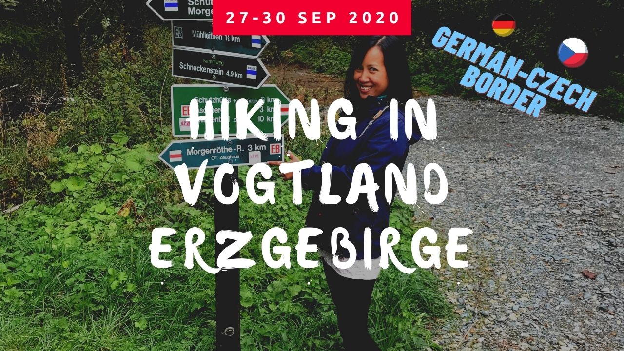
The hiking trails that we followed on all three days are relatively broad and well-marked. The uphill treks are nothing too challenging, so I’d say they’re suitable for all fitness levels. Would recommend proper hiking shoes, though, because some parts are full of gravel and you’d hate to slip on your way down.

Arrival Day
We reached our accommodation in Klingenthal in the afternoon, so we could only go on a 10 km hike before it turned dark. Fortunately, there’s a myriad of hiking trails starting practically right outside our doorstep. You can check out our Day 1 route here.

We walked past the Aschberg information centre and observation deck, but didn’t climb the tower.

The forest looked mystical covered in mist.

Mushrooms popped up everywhere. Very likely the poisonous sorts.

We were lucky with the weather, as it stayed mild and dry except for some brief drizzling episodes.

Spruce and fir were the main trees we found in the Ore Mountains.

There’s a number of beautiful ferns, too.


Even moss looks photogenic here.

The Unterer Floßteich or artificial pond commonly found in a low mountain range (of which the Erzgebirge is an example) helps maintain water levels in nearby canals.

We finished our first day of hiking with dinner and sunset at Schöne Aussicht, a hilltop restaurant a stone’s throw away from our accommodation. The food won’t blow you away but the view definitely will.


Day 2
On the second day, J whipped up some quality breakfast to kick off the day. I had made an Apfelstrudel in Berlin a couple of days prior and we brought the leftover with us, so we gobbled that up too. Gotta fuel up before a long hike!

Gorgeous blue sky in the morning, and the weather held up. We managed to walk 22 km along the German-Czech border to Carlsfeld and back to Klingenthal. You can check out our Day 2 route here.

One of the longest cross-country skiing trails in Germany, the Kammloipe, is located in the Nature Park Erzgebirge/Vogtland.

It wasn’t long before we started seeing signposts in Czech.

There are border stones with the letter D on one side…

and C on the other.

There are plenty of signs warning you that you’re on state borders. Pozor in Czech is equivalent to Achtung in German or “Attention!” in English.

I think this is spruce?

Snow ruler!

The forest still brimmed with colours at the end of September.


We almost didn’t bump into anybody. A perfect social distancing exercise!

Unfortunately, the only restaurant in Carlsfeld was closed and we didn’t pack any meal with us (very smart). So, contrary to how I might look in this picture, I wasn’t pleased.

Somehow we managed to continue the hike without starving to death, and found this tree trunk that was close to 200 years old (as you could tell from the rings) exhibited near a forest shelter.

Found an Honesty Fridge a.k.a. Kasse des Vertrauens in German outside a closed restaurant in Muldenhammer and grabbed a drink for 2 EUR.

Educational posters explaining why the forest is colourful in autumn, and the oft-confused roe deer (Reh in German) and red deer (Hirsch in German).

A glimpse of another spectacular sunset from our living room in Klingenthal!

Departure Day
After two days of hiking, J and I spent one day at the nearby Bad Elster, where I wanted to spoil ourselves silly at the spa. We managed a short walk while we were there too, so perhaps I’ll write a separate post on it. In any case, I didn’t feel like hiking much on the next day when we had to return to Berlin anyway, so we did only 9 km. You can check out the route of our last day here.
The sky didn’t look promising when we started.

But it got better!

We walked from Mühlleithen along the Kamm mountain bike trail, then along the Floßgraben. The latter was presumably used to transport wood in the past, but I didn’t see any water in the canals when we were there.

Came across exactly ONE mountain biker.

I took some videos during our stay to give you a better idea of the nature park. You can watch our hikes in motion here.
Key stats and stops
Distance traveled: 10+22+9 km
Total ascent/descent: 401/440 m, 565/593 m, 261/272 m
Max altitude: 917 m, 954 m, 908 m
Difficulty rating: easy to moderate, suitable for all fitness levels
Terrain: A combination of paved and unpaved surfaces. Proper hiking shoes recommended for the forest.
Accommodation (check if COVID-19 restrictions apply): Ferienwohnung Familie Becher on Aschbergstraße 15, 08248 Klingenthal Aschberg
Dinner (be there to watch the sun set, check if COVID-19 closures apply): Schöne Aussicht on Aschbergstraße 19, 08248 Klingenthal
Hiking guides:
Our hiking paths along the Vogtland Panoramaweg near Klingenthal (Day 1) here, between Klingenthal and Carlsfeld (Day 2) here and along the Kammweg near Mühlleithen (final day) here
Stage 9 of Vogtland Panoramaweg on http://www.vogtland-tourismus.de/s/ZbRLP
Stage 12 of Kammweg on http://www.vogtland-tourismus.de/s/PWcv
Wanderweg der Deutschen Einheit (German Unity Hiking Trail) in Erzgebirge: https://www.erzgebirge-tourismus.de/wandern/wanderwege-touren/tour/wanderweg-der-deutschen-einheit-wde-abschnitt-erzgebirge/tour.html
Other hiking paths in the Vogtland region on the Vogtland tourism site
Such beautiful descriptions and pictures! I’ll have to plan a hiking trip to Vogtland Nature Park in 2021 🙂
Thanks, the park is definitely worth a visit!